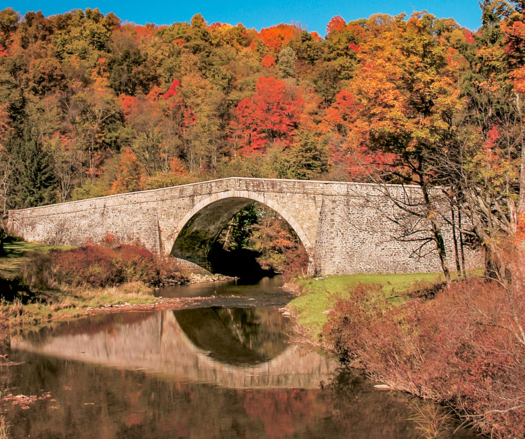
Casselman River Bridge State Park
Casselman River Bridge State Park attracts everyone from ardent anglers to hardcore history buffs. Once part of a busy thoroughfare known as “Little Crossings,” the four acre park is home to both trophy size trout and a bridge that made history with its innovative design.
About the Casselman River
Rising atop the plateau of Western Maryland, the Casselman River follows a great arc across the Laurel Highlands of Somerset County, PA to the appropriately named town of Confluence, where Laurel Hill Creek joins a few yards above the Youghiogheny River. The Casselman River is relatively wide and has a variety of habitats. Anglers will find deep runs, large deep holes and even some pocket water. The streambed consists of mainly cobble-size stone, making wading easier when compared to other area rivers. Natural flows can fluctuate especially during the spring, so be sure to check with the DNR for flow conditions. Flows less than 150 cubic feet per second (cfs) are typically considered good fishing flows. The trout fishery in the Casselman River Delayed Harvest Trout Fishing Area is managed using adult hatchery brown and rainbow trout stocked each spring and fall. Many of these trout are truly trophy size and can reach sizes greater than 5 pounds! The Delayed Harvest Trout Fishing Area management scheme includes a Catch and Release Season when anglers may use artificial lures or flies only. Consult the Maryland Freshwater Sportfishing Guide for complete details. Keep in mind that most of the land bordering the Casselman River is privately owned farmland. The Casselman River Bridge State Park is the only public land bordering the Delayed Harvest Area.
History of the Casselman Bridge
The area where the park is located was named Little Crossings in 1755 by George Washington. At that time, he was young military aide on the staff of British General Edward Braddock. Braddock led an army against a French fort near what is now Pittsburgh. Braddock’s army forded the river at Little Crossings and also retreated back over the same spot after being defeated by the French. After the French had been driven out of North America, Joseph Tomlinson erected the first inn several miles east of Little Crossings. Linking Cumberland, MD to the Ohio River, the ford, and the road that crossed it, became a major thoroughfare of westward travelers. By the late 1700’s, a mill and farm residences were built near the crossing.
During the early 1800’s, the federal government began an ambitious program of internal improvements. The improvements included widespread road construction to help solidify the young republic. The National Road project was a capital improvement program that aimed at upgrading Braddock’s Road. The Casselman River Bridge was one of many such projects. At the time of its construction in 1813, the 80-foot span single arch stone bridge was the largest of its kind in the country. It was reportedly made longer than it needed to be in hopes that the planned Chesapeake and Ohio Canal would pass under it. A public celebration was held at the bridge on the day that workmen removed the supporting timbers. Skeptics predicted the bridge would collapse once the supporting timbers were removed. To the amazement of many, the bridge did not collapse. Little Crossings quickly became a busy center of commerce and transportation. Stage coaches, wagons, horsemen and foot travelers crossed over the bridge. More buildings appeared, including a store, and another inn, which remains today, as Penn Alps Restaurant.
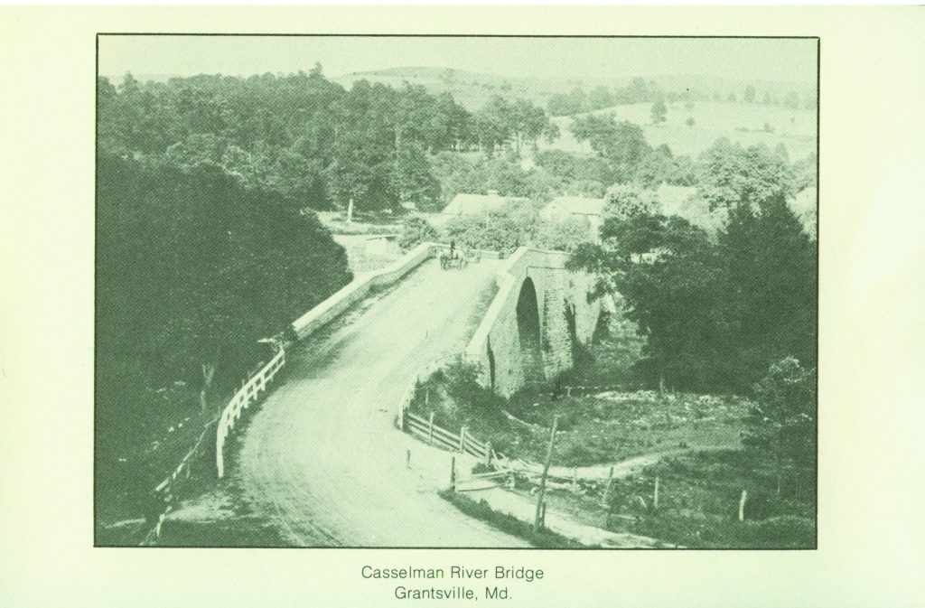
The advent of the railroads in the 1840’s resulted in cheaper travel. The National Road fell into disuse but was revived in the early 20th century when federal aid became available for the road development to accommodate a newer means of transportation – the automobile. The bridge continued in service until U.S. Route 40 also became an important east-west artery, just as the National Road had been. In 1933, a new steel bridge joined the banks of the Casselman River. The old stone bridge was partially restored by the State of Maryland in the mid-1950’s becoming the focal point of the Casselman River Bridge State Park.
Park Amenities
Offering a picnic area with public rest rooms, the four acre park is an ideal spot to appreciate the outdoors. Enjoyed by early morning anglers and lazy afternoon loungers, Casselman River Bridge State Park offers everyone an opportunity to experience a picturesque relic of our nation’s early transportation history along with the natural beauty Western Maryland is known for.
For more information visit https://dnr.state.md.us/publiclands/Pages/western/casselman.aspx or call (301) 895-5453.
Directions – From I-68 take Exit 19, Grantsville. Go into Grantsville and turn right on Route 40 E. Proceed about .5 miles to the Casselman River Bridge State Park on the left, or continue on Route 40 across a steel bridge and turn left onto River Road. River Road parallels the river to the PA State Line, about five miles. There are ample pull-offs along the road, and please be respectful of the private property owners.
Posted on 04/21/2020 in Garrett County History # Deep Creek Lake